
Verified Views
28 Aug 2024
Verified Views
Verified images combine existing photography with a precise representation of a proposed development, produced to the standards required for planning applications and public inquiry.
Category
Verified Views
Reading Time
5 Min
Date
Seeing Is Believing: The Case for Verified Imagery in Planning
When a development proposal goes before a planning authority, words and drawings can only go so far. Decision-makers, consultees and the public all want to understand what a scheme will actually look like, not an impression of it, but a credible, defensible prediction.
That's where Accurate Visual Representations (AVRs) come in.
An AVR precisely combines photography of an existing location with a rendered representation of a proposed development. The result communicates far more than a standalone CGI: it shows the position, massing, visibility, architectural character and materiality of a scheme within its real-world context, under defined lighting conditions, at a specific time of day, from a surveyed viewpoint.
Because the methodology behind every image is transparent and auditable, AVRs give clients, planners and stakeholders genuine confidence in what's being proposed. You may also hear them referred to as Visually Verified Montages (VVMs), Verified Photomontages, Certified Views or simply Verified Images, the terminology varies, but the rigour doesn't.
What Level Do You Need?
AVRs are produced to one of four levels of detail, as defined in the Landscape Institute's 'Visual Representation of Development Proposals. The right level depends on the sensitivity of the site, the stage of the application and what the planning authority requires, and it's worth establishing this early, specifying too low a level can mean redoing work later.
Level 00 | Location and size of proposal. This equates to a photowire and provides an outline of the proposal overlaid onto the photograph base |
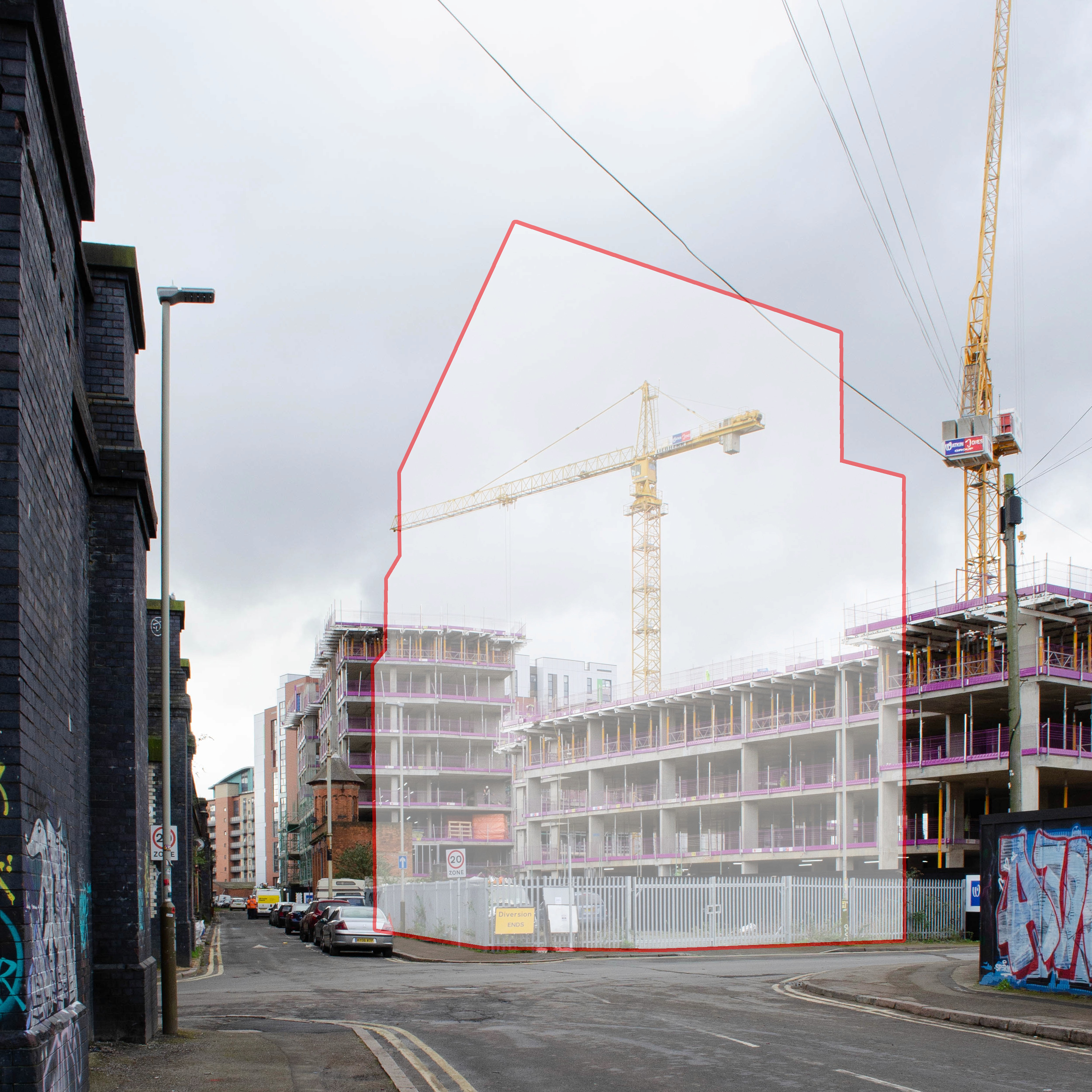
Level 01 | Location, size and degree of visibility of proposal. This shows the massing of the proposal within a 3D context represented by the photograph - that is, what can and cannot be seen |
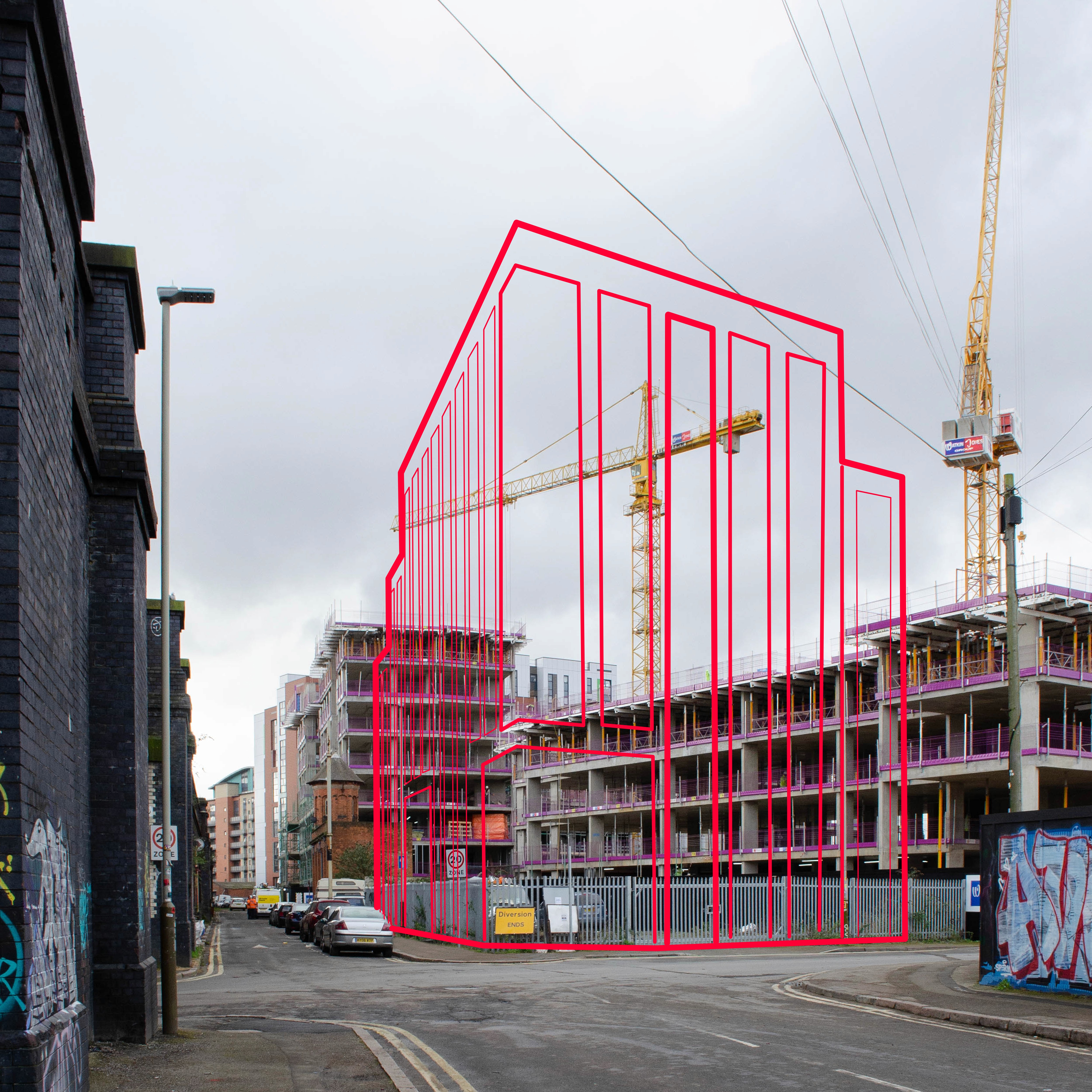
Level 02 | As level 1 + description of architectural form. This illustrates architectural form such as doors, windows and floors, and gives a sense of the form and shading of the development within its context. |
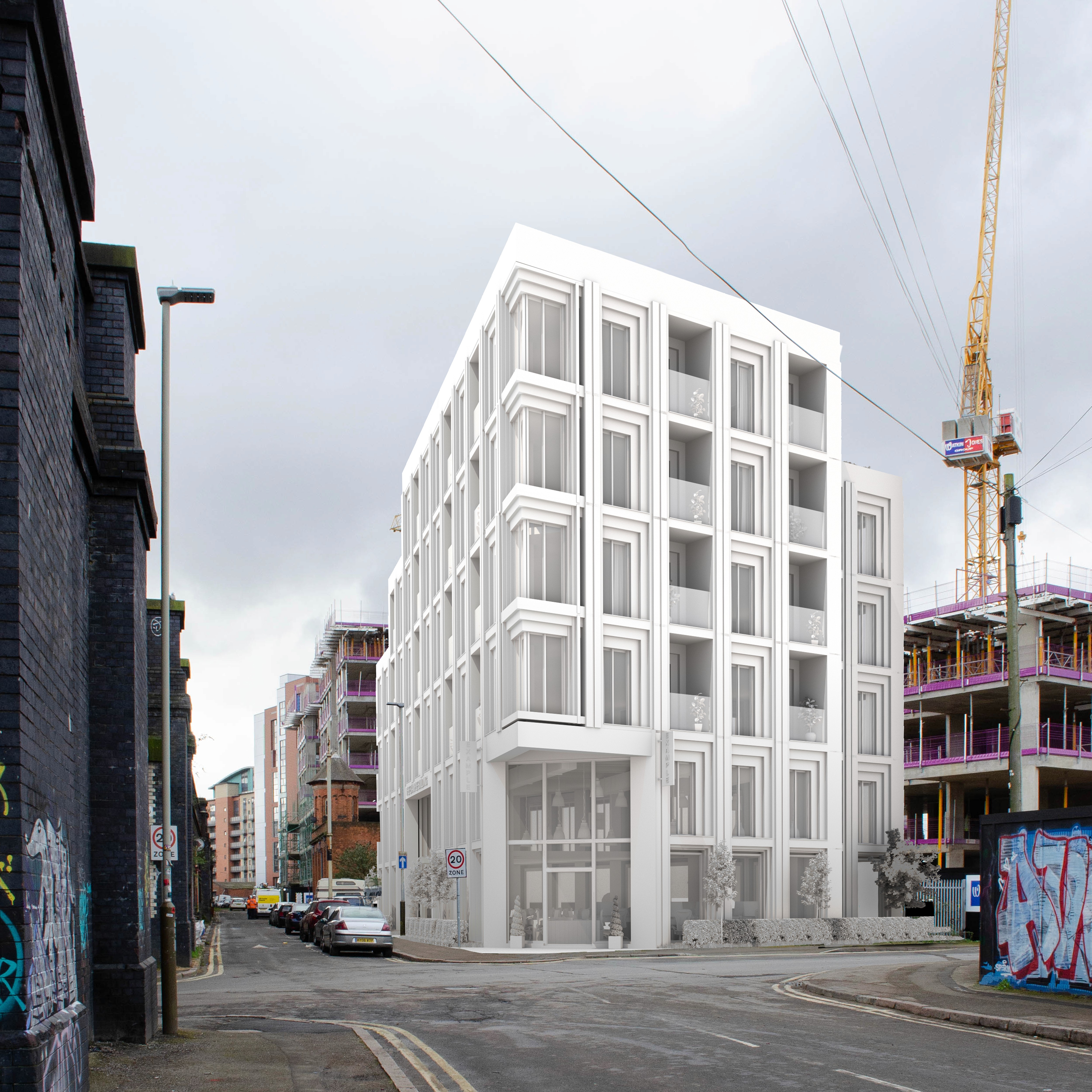
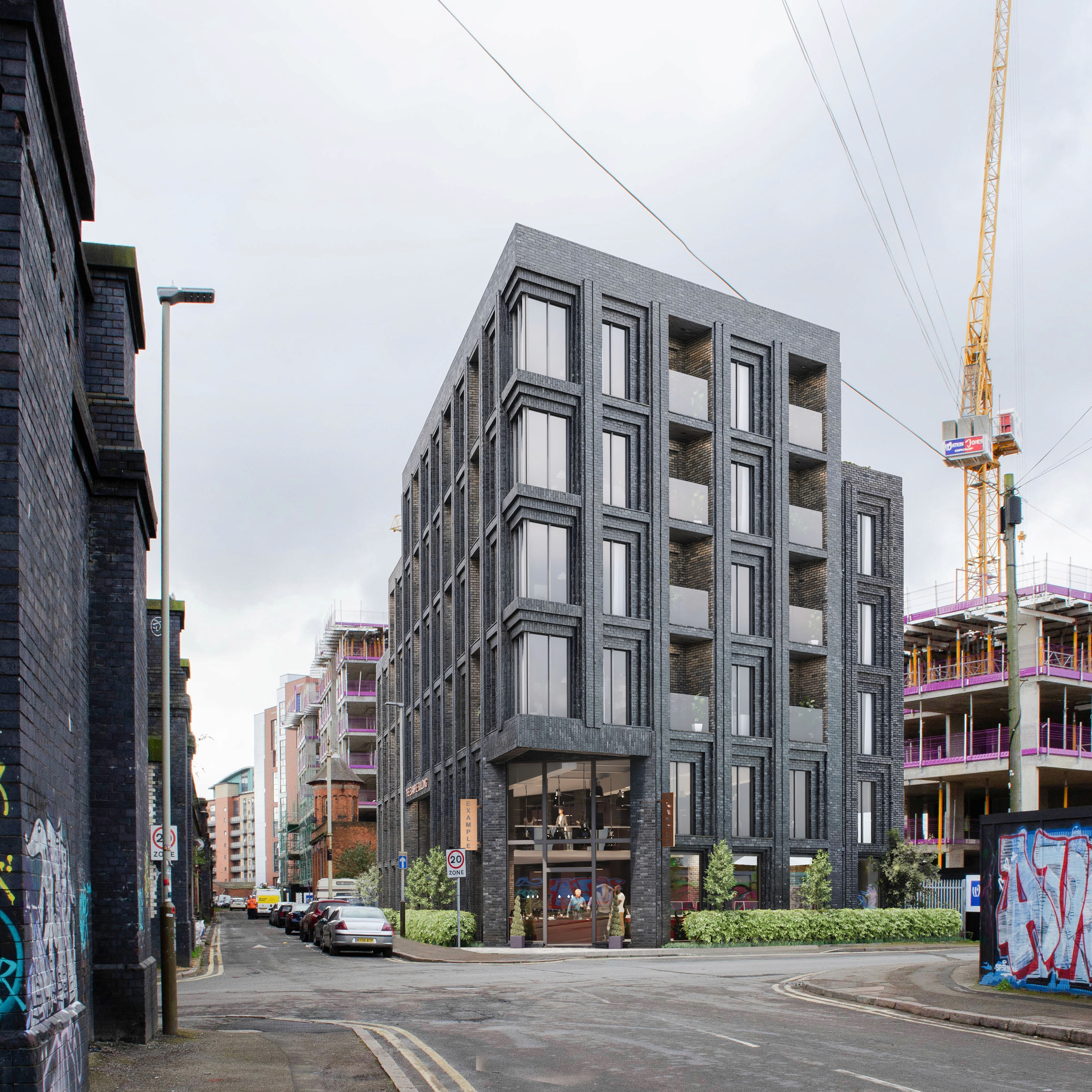
Level 03 | As level 2 + use of materials. This is a fully rendered photomontage, usually photo-realistic with texture, shading and reflections as appropriate. |
Getting the Foundation Right
The credibility of any AVR rests entirely on what happens before a single pixel of CGI is composited. Verified imagery begins on site.
Viewpoints are fixed using a combination of GPS and total station surveying to establish their precise position and height. Camera geometry, focal length, sensor size, lens distortion, is carefully recorded and matched in the 3D model, so the rendered element sits correctly within the photographic frame. Photography is taken under controlled conditions, with bracketed exposures (if required) to capture accurate lighting data and a clear record of date, time and weather.
This rigour isn't a formality. It's what separates a verified image from an illustrative visual, and it's what allows the work to withstand scrutiny at planning or public inquiry. Cutting corners at the survey stage compromises everything that follows, however polished the final image looks.
Working to Recognised Standards
Every verified image I produce follows industry-recognised methodology, drawing on three authoritative guidance documents:
The Landscape Institute's Guidelines for Landscape and Visual Impact Assessment (3rd edition, 2013) |
Technical Guidance Note 06/19: Visual Representation of Development Proposals (2019) |
The Revised Supplementary Planning Guidance: London View Management Framework (2012) |
A full methodology document is provided with every commission, written to the standard required for submission as part of a Planning Application, TVIA or LVIA.
My verified imagery and perception studies have been prepared in support of planning applications and public inquiries across a range of project types and scales. Based in Leicester, I work across the Midlands and throughout the UK. I also offer an independent verification checking service for those who need assurance that a third-party consultant's AVRs meet the required standard, whether for a planning submission or an inquiry appearance.
If you'd like to discuss what your project needs, feel free to get in touch.
Related Articles